- hot_tub
- bolt
- restaurant
- water_drop
- power
- electrical_services
-
14
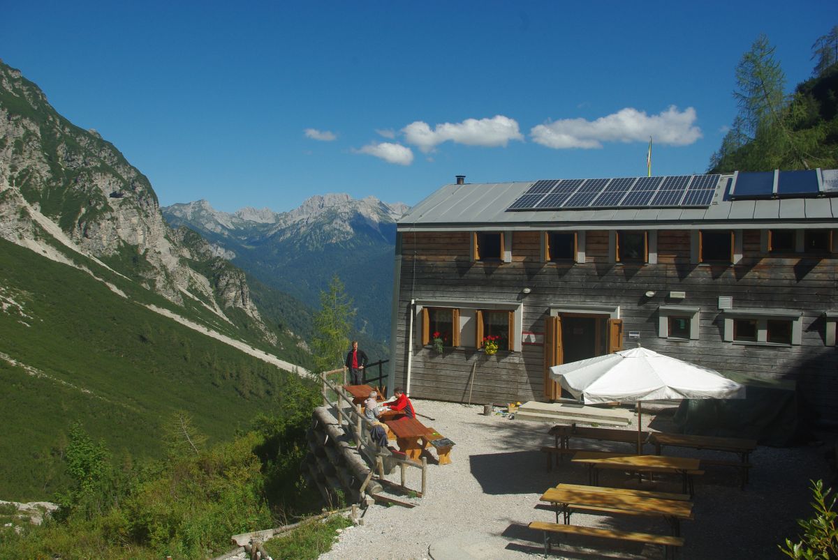
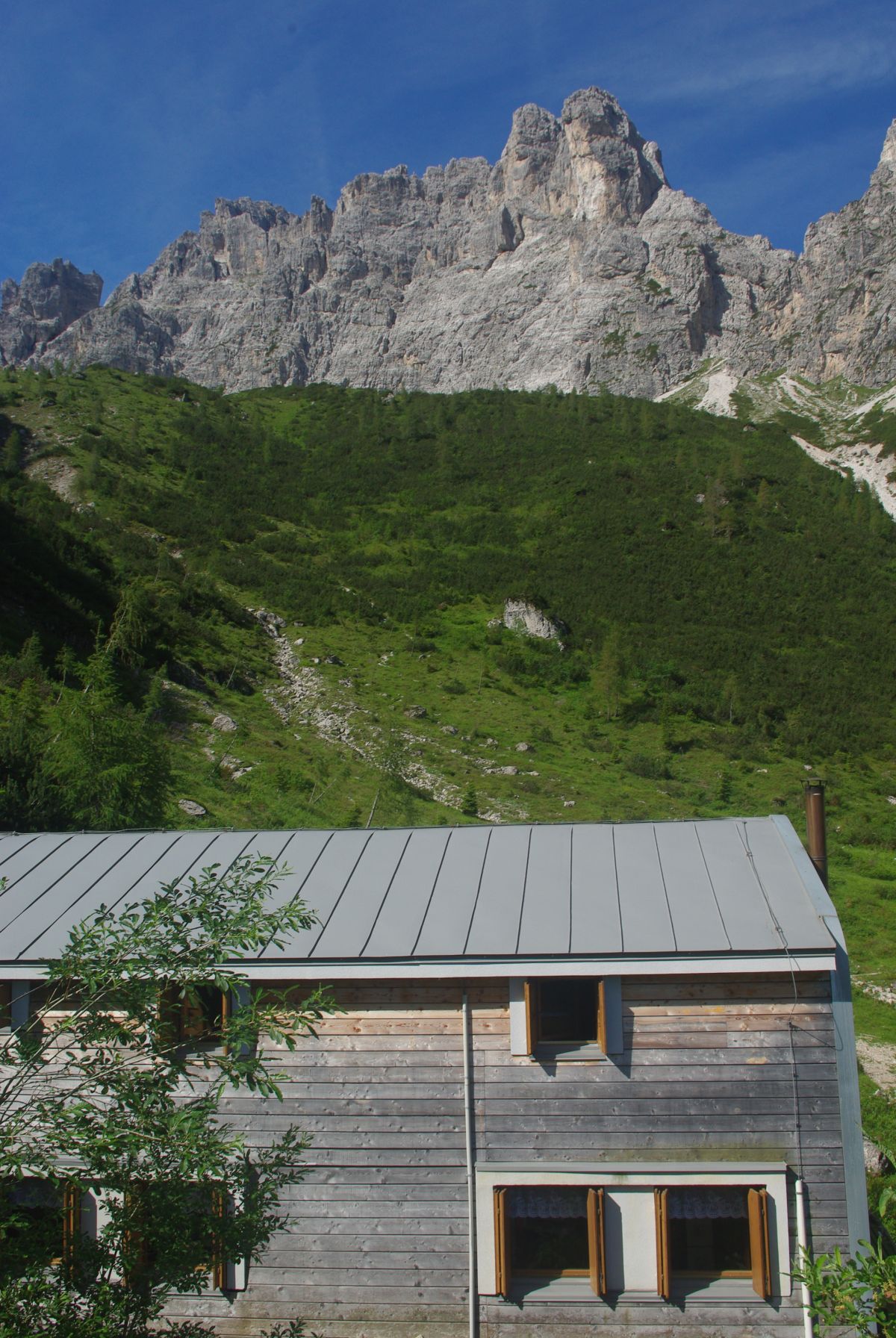

The refuge is located at the north-eastern entrance to the Friulian Dolomites Natural Park in the upper Val di Suola at an altitude of 1587 metres. It iseasily reached from the village of Forni di Soprain a two-hour walk along a mule track.
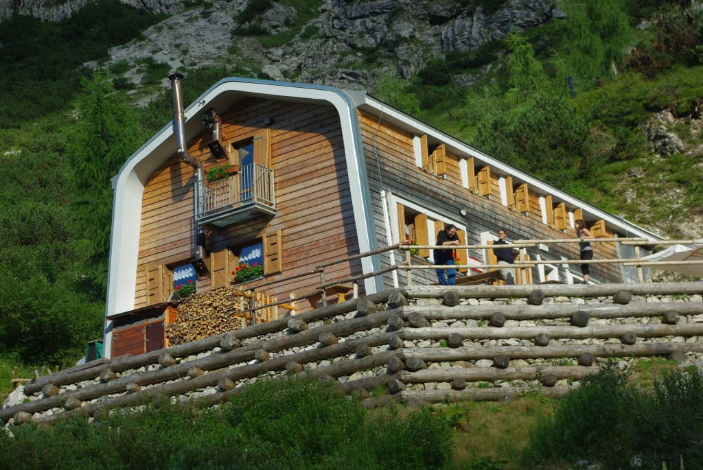
Built above a flowering terrace on the north-western slopes of the Cima di Suola, it consists of a new concrete construction entirely clad in larch wood, completed in 2008 and relocated exactly on the site of the old refuge. The panorama opens up to the circle of spires and dolomite peaks above, and the eye can sweep over the entire valley as far as Forni.
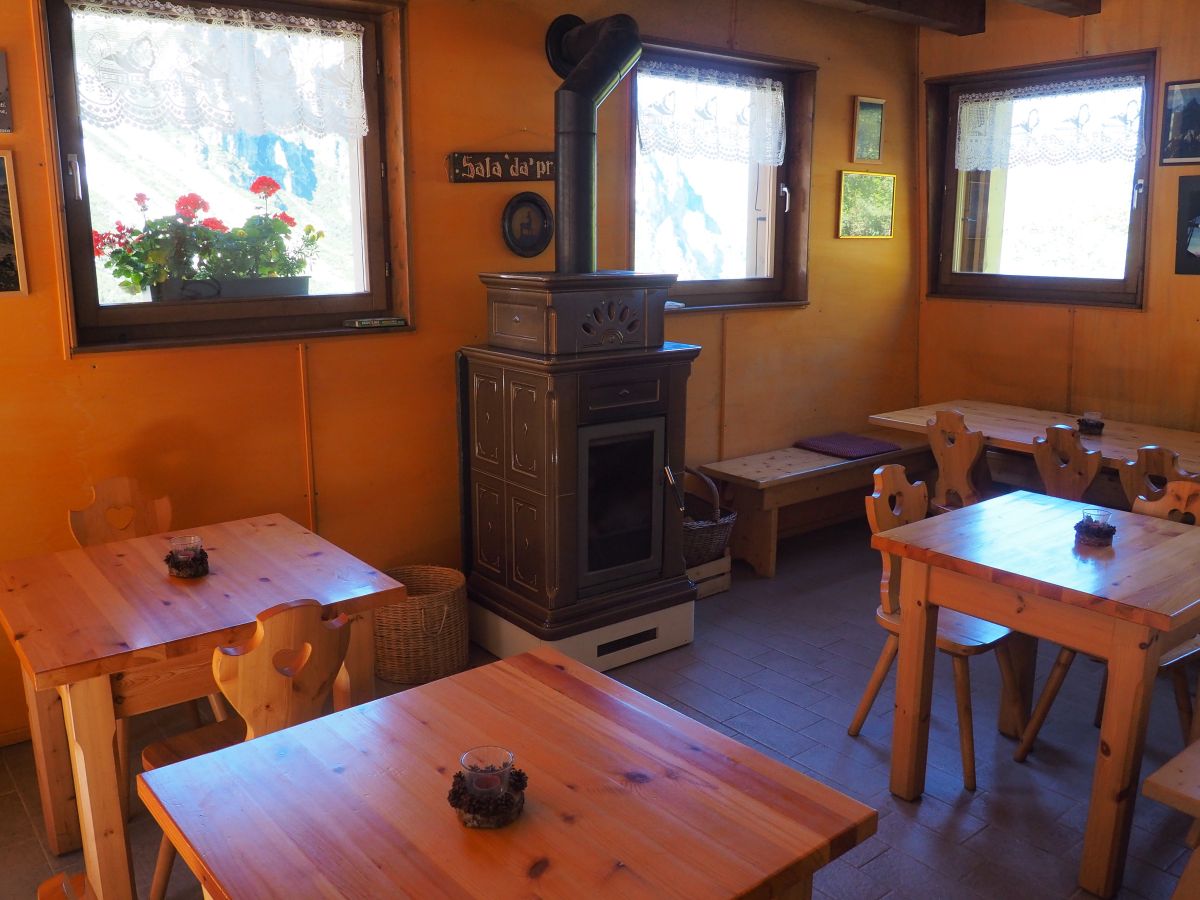
The hut is cosy, with a corner bar, dining room and library in two large rooms on the ground floor equipped with a wood-burning stove for heating. On the first floor there are three small rooms with a total of 14 beds.
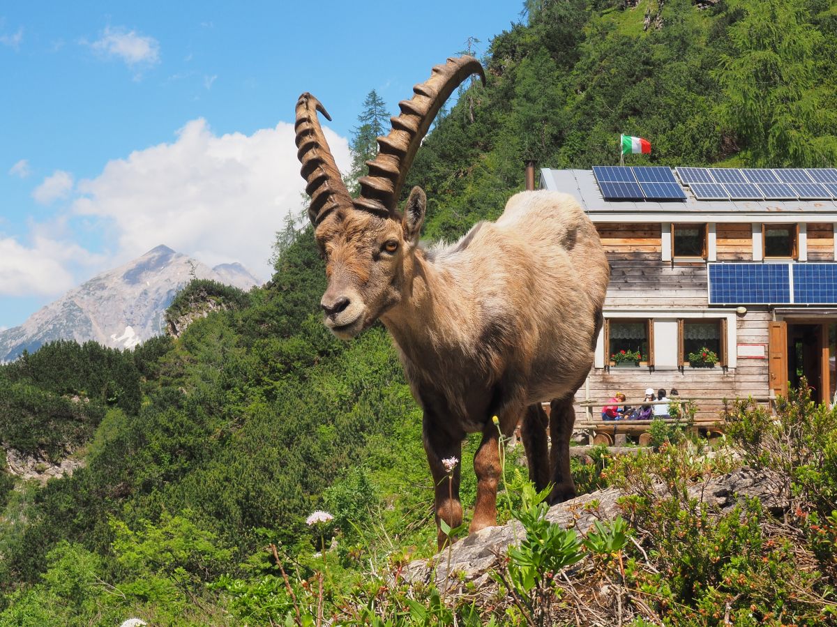
Even with the new hut, the integration with the environment and the authenticity of the place, which can only be reached on foot, has remained intact. It is totally autonomous in terms of energy and water, also thanks to solar and photovoltaic panels. A fresh spring has been captured and brought to flow right next to the hut.
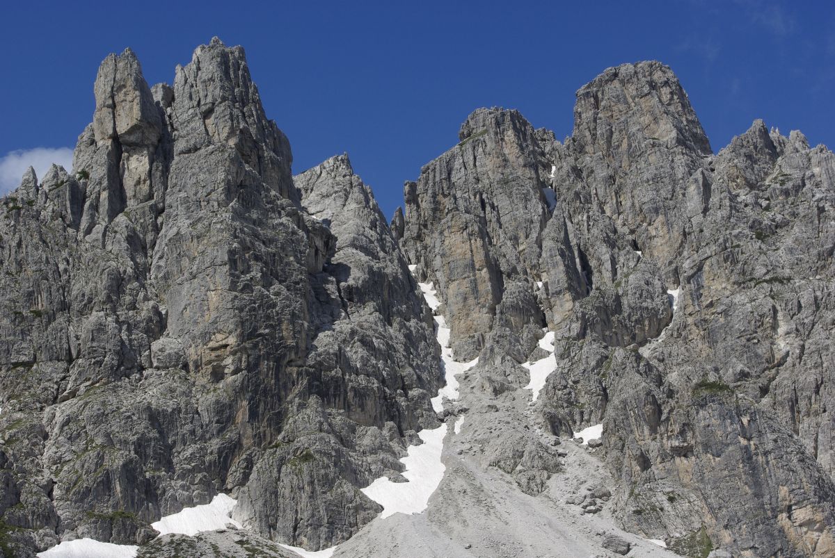
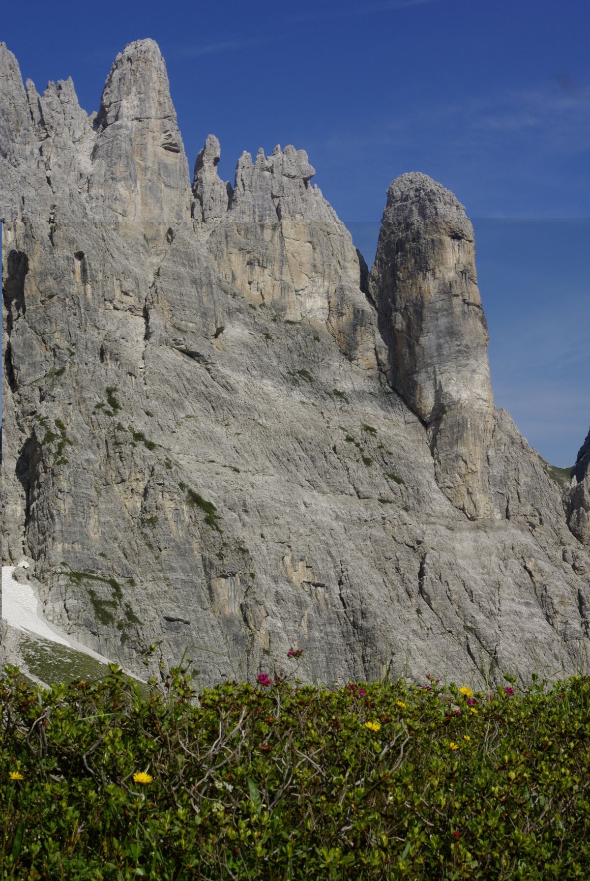
Arriving at the hut already surprises us in the heart of the typical Dolomite habitat, where the beech and larch forest gives way to long scree interspersed with swathes of mugo trees, with the looming Torrione Comici, Cima Val di Guerra, "The Castle" and the Cime Fantoline crowning it.
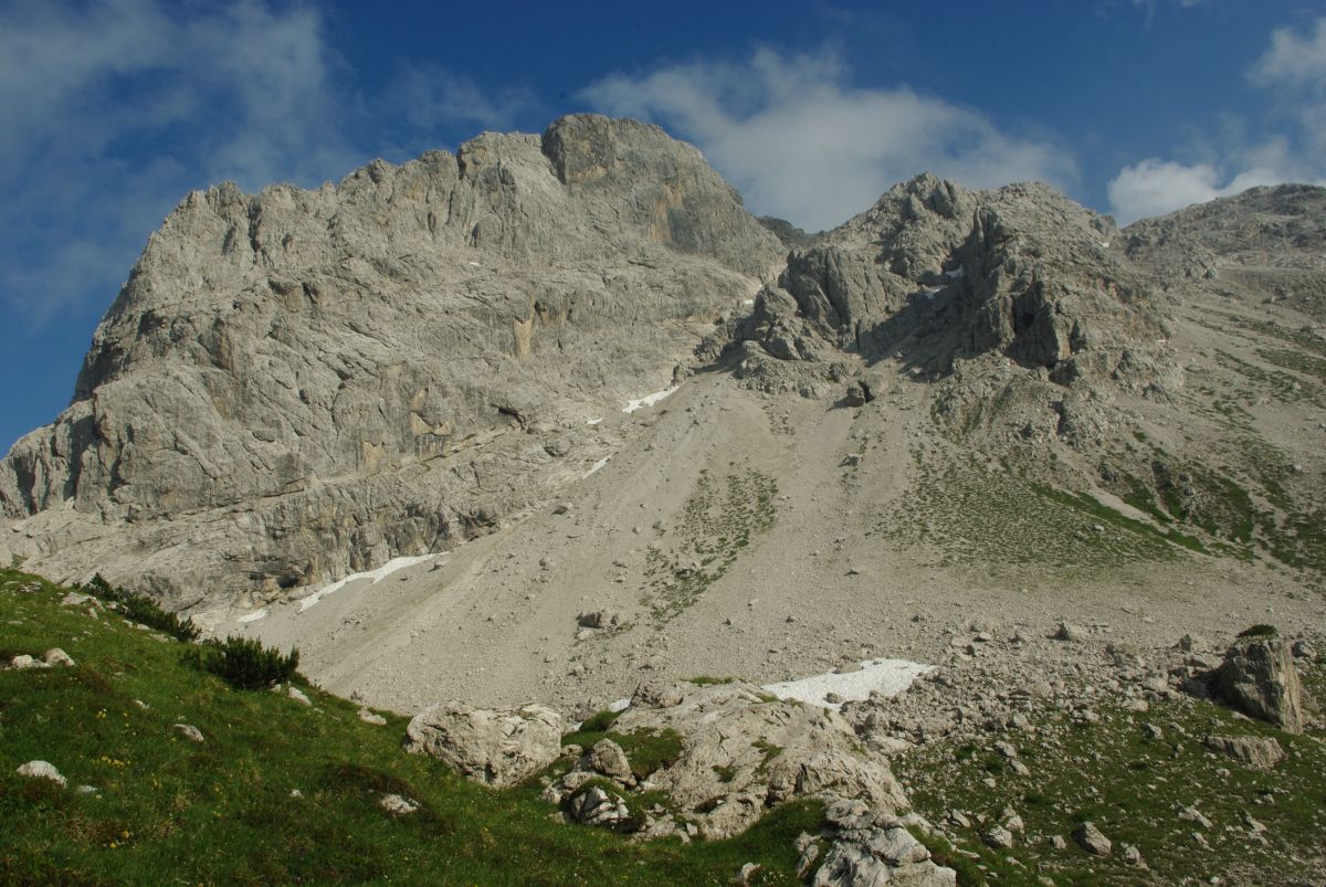
A further recommendable 'outing' takes an hour along the upper Val di Suola to the pass of the same name at 1990 metres, finding a fascinating landscape where it is difficult not to come across ibex: in the Pramaggiore group there is a stable colony that in summer moves to the northern slopes, pushing on towards the refuge.
From Passo Suola, heading north along a beautiful grassy ridge, it is possible to reach thesummit of the refuge(2100 m) in 30 minutes, with a splendid view of all the peaks in the valley.
The spectacular blossoming of the Dolomites can be appreciated at altitude, especially in June and July. Among the flowers to be discovered, mention must be made of the gentian that characterises the spectacular traverse to the Giaf refuge(Truoi dai Sclops - theGentian Path) and - at the beginning of the season - the famous and sought-after orchidPianella della Madonnaor Scarpetta di Venere.
The richness of the flora has allowed us to create a pleasant botanical trail with educational value along the flat path right near the hut.
Hiking TraversesA widespread network of well-marked trails and the optimal location of mountain huts and bivouacs make it possible to plan magnificent trekking itineraries in the heart of the Friulian Dolomites Natural Park:to the Giaf Refuge via the "Truoi dai Sclops" (sent. 362-369-361, 5-6 hours, E);
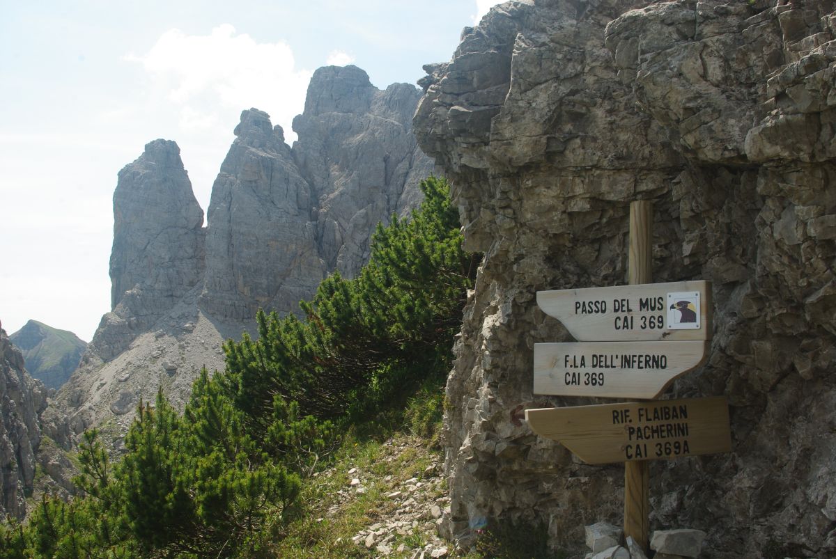
to the Pordenone Refuge by the Mus Pass (sent. 362, 3-4 hours, E);
to the Pussa Refuge via the Forc. Rua Alta and the Casera Pramaggiore Bivouac (sent. 363-366, 4-5 hours, EE);
Val di Rua loopwith departure and arrival in Andrazza (sent. 368-363-362, hrs. 6-7, EE);
Cresta delle Sarodinewith descent to Malga Masons and Forni di Sotto (trails 363-373, 7-8 hours, EE);
Alta Via di Forni: a circular traverse in 4 days to the Giaf Refuge and the Malghe Tartoi and Tragonia huts, riding the slopes that embrace Forni di Sopra.
The hut is also a stage point of the Carnia Trekking and Via Alpina high route.
Ascent to the valley peaks
Monte Pramaggiore(2478 m): Normal route to the highest and most panoramic peak of the group, within the reach of hikers (EEA, Grade I); Torrione Comici (2260 m):"Cassiopea" via ferrata.Challenging itinerary entirely equipped with ropes on a vertical and exposed wall. Via ferrata set required.For the more demanding hiker - on the threshold of real mountaineering, two proposals of normal routes to wild peaks of great charm:Cima Val di Guerra(2353 m) - North face and north-east ridge (I-II, steps II+);Croda del Sion(2410 m) - South-west face (I, steps II).
Immersed in the wilderness are several mountaineering routeson the walls of the valley, from grade IV upwards and on even excellent rock, in the footsteps of Sergio Liessi andRoberto Mazzilis.
From the main centre of Forni di Sopra (hamlet of Vico), descend to the bridge over the Tagliamento river from where, near the sports centre (881 m, car park, signposted), a forest road closed to traffic begins, which runs alongside the ski lifts and reaches the locality of Palas (widening with tables) in 20 minutes. This is also where the direct path from the hamlet of Andrazza arrives: below the hamlet, park near the Tagliamento, cross the river on the road bridge and at the hydroelectric power station take the path to the right (837 m, signposts).
Now begins the mule track that climbs gently up the wood and then on open, gravelly ground without any difficulty along the Val di Suola reaches the refuge at 1587 metres (2 hours in all) CAI trail marker no. 362
| Service | Non-members | CAI Members*info | CAI members under 25 |
|---|---|---|---|
| Room with more than four beds | 32.00 € | 22.00 € | 18.00 € |
| Room up to four beds | 32.00 € | 22.00 € | 18.00 € |
| Half board | 62.50 € | 50.00 € | 44.00 € |
| Full board | |||
| Emergency bed | 0.00 € | 0.00 € | 0.00 € |
| Bed & Breakfast | 40.00 € | 30.00 € | 26.00 € |
| Packed lunch | |||
| Sheet bag | |||
| Surcharge for heating |