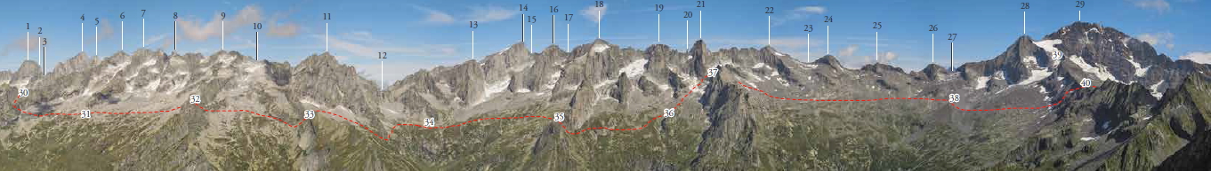
Rome Trail
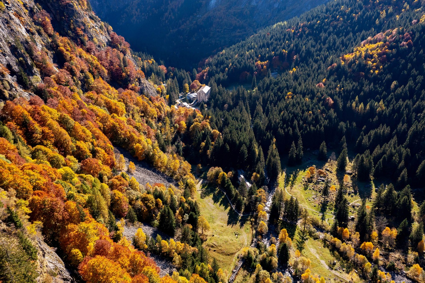
Sentiero Roma is a 54-km-long trek that takes place mostly at 2500 m above sea level and crosses Val Codera, the entire head of Val Masino and ends in Valmalenco.
To walk it in its entirety requires 5-6 days of walking.
- timer4 hours
- trending_up
- trending_down
Distance: 11 km
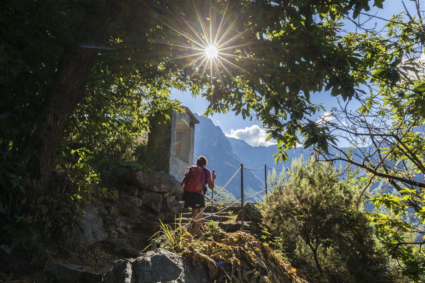
The trail starts from the square in Mezzolpiano (311 m). A long, stepped mule track flanks the granite wall that encloses the valley until it reaches the small hamlet of Avedè (790 m). From here the trail continues uphill to the square of the charming village of Codera (825 m, 2.00 hours).
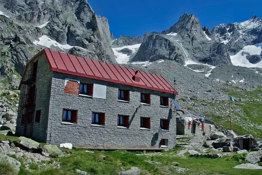
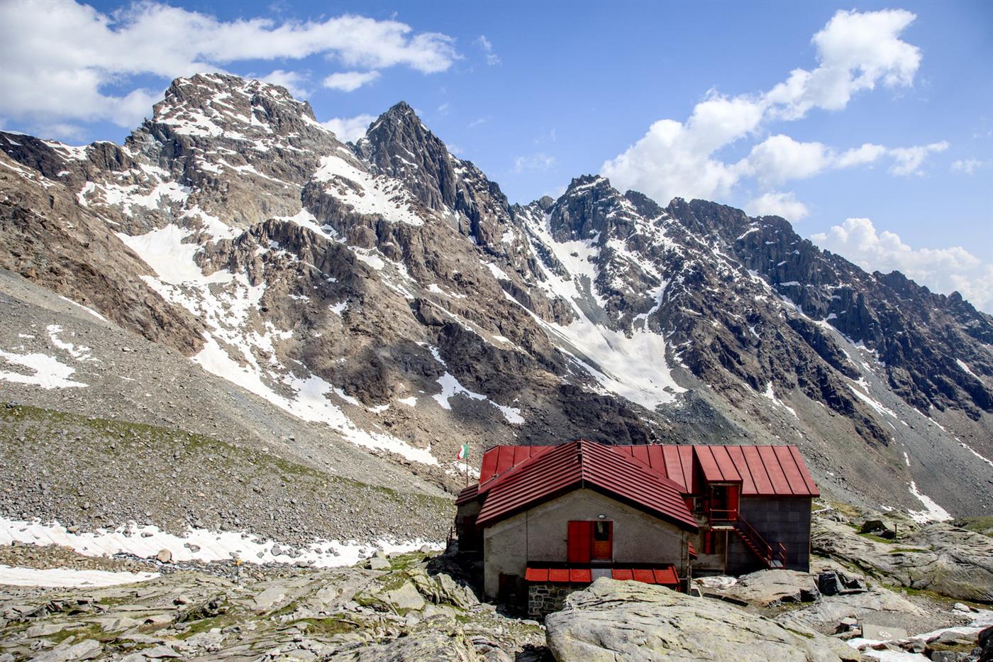
Continuing between ancient huts, you reach the sign indicating “Sentiero Roma.” Passing Saline and Stoppadura, you reach the locality “Bresciadega” (1214 m), continue further into the pine forest, reach the bridge over the Arnasca stream until you reach a large clearing where the Brasca refuge is located (1304 m 2.00 hours).
- timer5 hours and 20 minutes
- trending_up
- trending_down
Distance: 7.2 km
Leaving the Brasca refuge, the trail enters the upper Codera Valley. Soon you meet the sign for Barbacan Pass. We walk through the Averta Valley until we reach the Averta huts (1957 m 1.50 hours).
Barbacan Pass is located to the left of the summit of the same name. The trail first continues over high elevation pastures to the Gold Pass junction and then continues over uneven scree until it reaches the gully, which gradually narrows to the pass notch (2598 m 2.00 hr). The pass is equipped with fixed ropes at the most inaccessible points.
From Barbacan Pass (northwest), an arrow can be seen indicating the entrance to the Porcellizzo Valley.
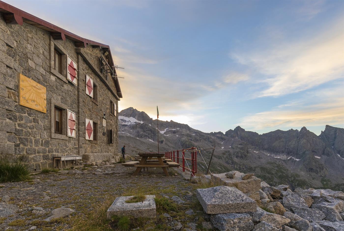
The descent is steep and challenging at first. When you reach the junction for Barbacan Pass “southeast,” continue to the “Gianetti refuge,” which is reached after a few ups and downs (2534 m 1.30 hours).
- timer3 hours and 50 minutes
- trending_up
- trending_down
Leaving the Brasca refuge, the trail enters the upper Codera Valley. Soon you meet the sign for Barbacan Pass. We walk through the Averta Valley until we reach the Averta huts (1957 m 1.50 hours).
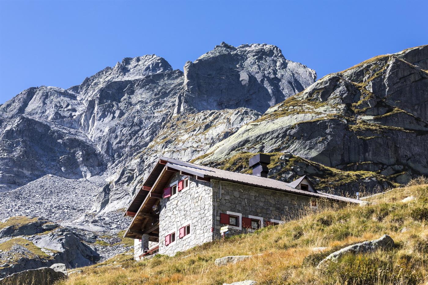
Follow the trail up the scree valley until you reach the pass (2574 m 2.00 h). By grassy slope, follow the descent into Valle dell’Oro to intercept the “Sentiero Risari”) and from here continue until you reach the Omio hut (2100 m 1.00 hour).
The following day, to reach the Gianetti refuge, follow the Risari Trail (Val Masino variant www.sentieroroma.it/variante-val-masino)
- timer5 hours and 50 minutes
- trending_up
- trending_down
Distance: 10.5 km
From the hut we cross the eastern part of the Porcellizzo Valley to Pizzi Gemelli. From here the trail alternates between grassy and stony sections until it becomes steeper and more impassable near Camerozzo Pass (2763 m 1.40 hours). The ascent to the pass is equipped.
Upon reaching the pass, the trail descends into the Iron Valley. The descent, despite being equipped, is very steep and very exposed (for those suffering from vertigo, it is recommended to consider the Roma Trail in the opposite direction). Upon reaching the base of the steep wall, the trail enters the wild Iron Valley. In the center of the valley a sign indicates the “Molteni Valsecchi” Bivouac (2560 m 1.10 hours).
The traverse is completed by traversing a long plateau to the base of Qualido Pass (2674 m 50 min), the ascent of which is by a scree-filled gully that presents no great difficulty.
More arduous is the descent from the opposite slope. The trail trace, after a somewhat airy traverse, descends down the steep wall until it reaches the pastures of Val Qualido. The most exposed sections are equipped.
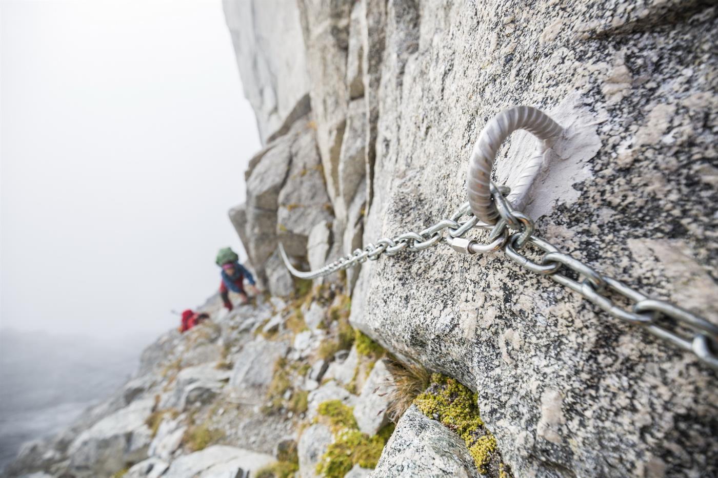
Cross the valley to reach the mouth of a scree gully that allows you to ascend, via chains, the narrow Averta Pass (2540 m 1.00 h). The descent into Zocca Valley is via a steep equipped ledge to a verdant plateau. The trail goes around the imposing Cima di Zocca, an equipped section, and descends in hairpin bends for about ten meters. The trail climbs north, bypasses a steep depression and descends to reach the Allievi Bonacossa hut (2385 m 1.10 hr).
- timer8 hours and 40 minutes
- trending_up
- trending_down
Distance: 11.2 km
After an ascent over terrain made uneven by a succession of creeks, grassy stretches, scree, and slabs, we reach the Nougat Pass (2518 m 1.15 hr.)
The descent into Val Torrone requires attention as the gully is steep and narrow. The most inaccessible spots are equipped.
Upon reaching the Torrone Valley, the trail bends left until it reaches the base of the imposing Luigi Amedeo Peak; from here the trail descends to circumvent a treacherous plaque. Climb up a steep grassy section to the junction for the Manzi Pirotta bivouac (2538 m 1.30 hr). Ascend the slope to the left until you reach the wide basin at the foot of East Nougat Peak. Here you cross to the left a small snowfield that (depending on the period) requires crampons and ice axe, until you reach the base of the pass. Sentiero Roma continues on the left flank, over steep rocks equipped with chains, until it reaches the Cameraccio Pass saddle (2950 m 1.30 hours).
We leave the pass with a gradual descent to an altitude of 2700 m. From here begins the great traverse of the entire valley juggling huge granite blocks.
Just beyond the center of the valley is the Kima Bivouac (2700 m. 2.00 h) located on the ancient moraine at the base of Mt. Pioda.
The trail descends along the edge of the lateral moraine of the glacier until it reaches the basin, which is crossed at an elevation of 2580 m.
It climbs up through scree to the base of the Remoluzza/Arcanzo Coast, where a modest snowfield requires (depending on the period) the use of crampons and ice axe. After finishing the snowfield, climb up the steep equipped rocks until you reach Bocchetta Roma (2898 m 1.30 h).
The descent to the hut is short, but not to be underestimated as it requires dexterity and attention over large boulders until reaching gentler, grassy sections leading to the Cesare Ponti hut (2559 m 50 min).